Attractive Places of Hunza
Duikar Valley Hunza:
Duikar is a charming hamlet above the village of Altit which is situated next to Baltit, Karimabad. Karimabad is the capital of the former state of Hunza. The state of Hunza was ruled by the same family for over 960 years, with their seat being the Baltit Fort. Both Baltit Fort and the even older Altit Fort are worth a visitor before you come up to Duikar or on your way down.
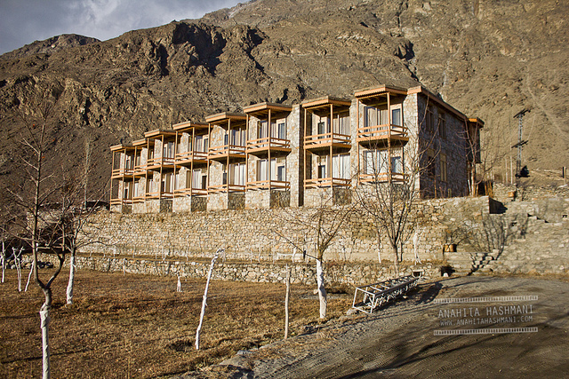
One of the main attractions of Duikar is the viewpoint (2900 m) which is a 5 minute climb up behind Eagle’s Nest Hotel. Here you have the best views during sunrise and sunset, if you have the chance come to Eagle’s Nest Hotel at full-moon. Starting from Eagle’s Nest Hotel it is a 1 ½ hours climb up to Hosht (3600 m).
From the highest viewpoint you have great views of Ultar Mountains and Hopper glacier. The Hunza panorama is wider and dearer here.
Attaabad Lake (Hunza):
Attabad Lake, Gojal, also known as Gojal Lake, is a lake in the Gojal Valley of northern Pakistan created in January 2010 by a landslide dam.
The lake was formed due to a massive landslide at Attabad village in Gilgit-Baltistan, 9 miles (14 km) upstream (east) of Karimabad that occurred on January 4, 2010. The landslide killed twenty people and blocked the flow of the Hunza River for five months. The lake flooding has displaced 6,000 people from upstream villages, stranded (from land transportation routes) a further 25,000, and inundated over 12 miles (19 km) of the Karakoram Highway.
The lake reached 13 miles (21 km) long and over 100 metres in depth by the first week of June 2010 when it began flowing over the landslide dam, completely submerging lower Shishkat and partly flooding Gulmit. The subdivision of Gojal has the greatest number of flooded buildings, over 170 houses and 120 shops.
Gulmit Gojal Hunza:
Gulmit is the headquarter of the Gojal Tehsil, in the upper Hunza region of the Gilgit territory in the deep in the Karakoram Mountain Range. Gulmit is a centuries-old historic town, with mountains, peaks and glaciers. It is a tourist spot and has many hotels, shops and a museum. Its altitude is 2408m (7900 ft) above the Arabian Sea level.Small hamlets consist of Kamaris, Odver, Dalgiram, Laksh, Kalha, Shawaran, Khor Lakhsh, Chamangul and Goze. Gulmit, is also a Turkish or Iranian word which means the valley of flowers.
Hotels in Gulmit:
There are well furnished hotels in Gulmit valley. Some of these hotels are Silk Route Lodge, Marco Polo Hotel, Village Guest House, Gulmit Tourist Inn, Shutubar Inn and Horse Shoe Motel (not in running condition).
Passu Village:
Passu is a small vill age on the Karakoram Highway, beside the Hunza River, some 15 kilometers from Gulmit, the Tehsil Headquarter of Gojal in the Gilgit-Baltistan region of Pakistan, and about 150 km upriver from Gilgit. It lies very near the tongue of the Pasu Glacier, and just south of the tongue of the Batura glacier. The latter is the fifth longest non-polar glacier in the world at 56 km, and reaches very near to the highway. The people are Wakhi and speak the Wakhi Language. Religiously they are Ismaili, a sect of Islam.
Tupopdan, 6,106 metres (20,033 ft), also known as "Passu Cones" or "Passu Cathedral", lies to the north of the village; it is the most photographed peak of the region. Also nearby are the high peaks of Pasu Sar, Shispare Sar, and Batura.
Passu Glacier:
Passu Glacier is situated in the south side of Passu village. Passu Peak is situated in the back site of the glacier. This glacier is linked with Batura Glacier and many other glaciers of the region. They are located north of Attabad lake at 6 Km and l0 Km respectively. Passu Glacier, length = 26 Km Batura Glacier, length = 58km.
Batura Glacier:
Batura Glacier (57 km (35 mi) long) is one of the largest and longest glaciers outside the polar regions. It lies in Batura Va lley Passu in Gojal region of the Gilgit-Baltistan of Pakistan, just north of Batura (7,795 m (25,574 ft)) and Passu (7,500 m (24,600 ft)) massifs. It flows west to east. The lower portions can be described as a grey sea of rocks and gravelly moraine, bordered by a few summer villages and pastures with herds of sheep, goats, cows and yaks and where roses and juniper trees are common.
Sust or Sost:
Sust or Sost is a dry port  in Gojal region of the Northern Areas of Pakistan. It is the last town inside Pakistan on the Karakoram Highway before the Chinese border. The town is an important place on the Karakoram Highway for all passenger and Cargo transport because all traffic crossing the Pakistan-China border passes through this town and the Pakistani immigration and customs departments are based here. Pakistan and China have opened border for trade and tourism at Khunjrab. Silk Route Dry Port, the port has also started its business operations at the port Sost (Upper Hunza) near Khunjarab pass Gilgit-Baltistan.
Khunjerab Pass (4,693 metres):
Khunjerab  Pass (elevation 4,693 metres or 15,397 feet) is a high mountain pass in the Karakoram Mountains in a strategic position on the northern border of Pakistan's Gilgit–Baltistan region within the region of Kashmir and on the southwest border of the Xinjiang region of China. Its name is derived from Wakhi 'Khun' means Home and 'Jerav' means spring water/water falling.


 10 o C
